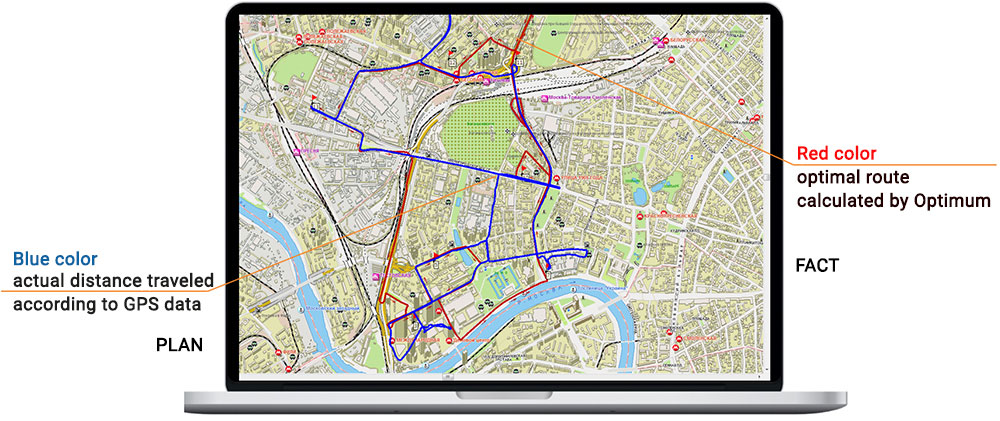
Satellite monitoring of vehicles using signals from GLONASS / GPS navigation systems is carried out in the Optimum SmartGIS geographic information system.

Key features
- Satellite monitoring of the movement and location of transport (visualization of the Plan-Fact routes).
- Monitoring the readings of any sensors installed in the car (for example, opening the doors, changing the temperature in the refrigerator, fuel level, etc.).
- Monitoring the readings of the sensors of the driver's mobile device (GPS / GLONASS, accelerometer, gyroscope).
- Control of emergency situations, deviations from the route.
- Automatic receipt of notifications about emergency situations (alarms).
- Checking the passage of control points of the route in time.
Related software
Optimum SmartGIS
Zlenko T.V., National Direct Distribution Manager, SUN InBev JSC


