Transport route planning
The optimal routes for the delivery of goods are calculated in the Optimum SmartGIS geographic information system, taking into account many parameters.
Key features
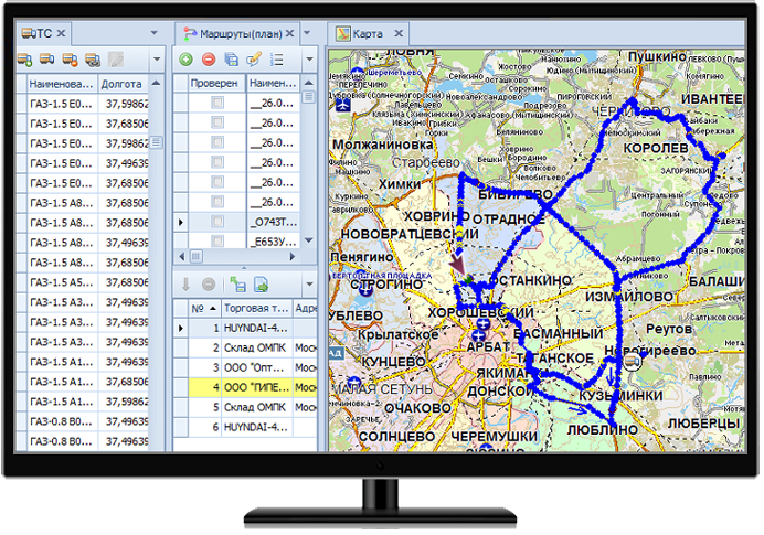
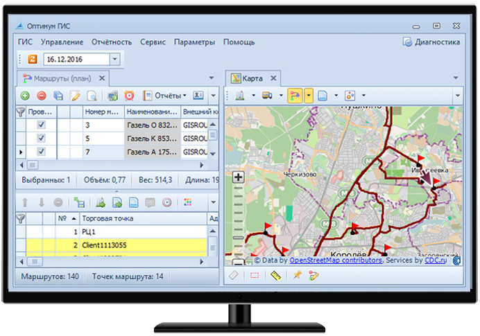
- Calculation of the vehicles optimal routes, taking into account the road situation, vehicle type, carrying capacity, body volume, flight cost, carrier rating, delivery windows (40+ calculation parameters).
- Possibility of customization for the client's process (own production engine).
- Connecting cartography from different manufacturers: Ingit, Yandex.Maps, Google Maps, OSM (MapQuest), 2GIS, Navikom, CityGuide, HERE.
- Support for geographically distributed projects of the scale of the Russian Federation (hierarchical directories, access rights, data delimitation, with a single database and analytics).
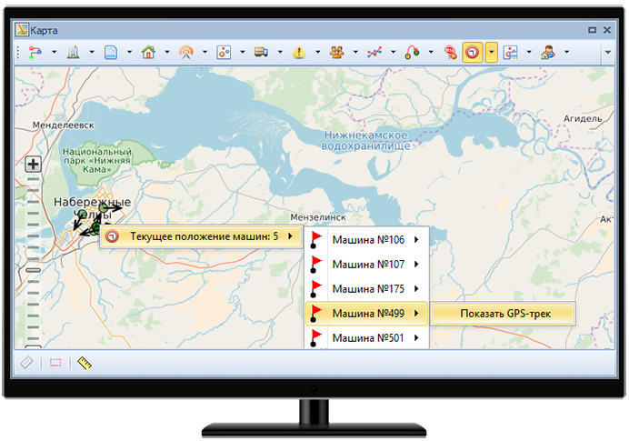
- Calculation and control of routes from a single center (routing for branches) ..
- The ability to install a solution at the customer's site without elements in the "cloud" according to IS requirements, including a cartographic engine.
- The use of artificial intelligence algorithms (neural networks) in the processing and analysis of data on sensors-drivers-cars (having our own ML practice).
- Accounting for own and borrowed vehicles.
- Reducing route crossings.
- Formation of route sheets.
- Receiving analytical reports.
Related software
Optimum SmartGIS
Zlenko T.V., National Direct Distribution Manager, SUN InBev JSC


Contact us
Related articles All articles
 News
News
27 september 2018
The Optimum GIS reduces the costs of transportation of AB InBev brewing products
 News
News
01 april 2017
CDC presents SFA solutions at L’Oreal conference
 News
News
01 march 2016
SUN InBev Implements the Optimum TMS to Automate Transport Logistics
 News
News
16 january 2016
CDC Automates Collection and Delivery of Mail at ‘Spetssvyaz’ Rossii’
 News
News
03 december 2015
HILTI Selected Optimum GIS to Automate Transport Logistics